Geological Subsurface Model and Advice Geo-hazards
Geological Subsurface Model and Advice Geo-hazards
Client: Ennatuurlijk B.V.
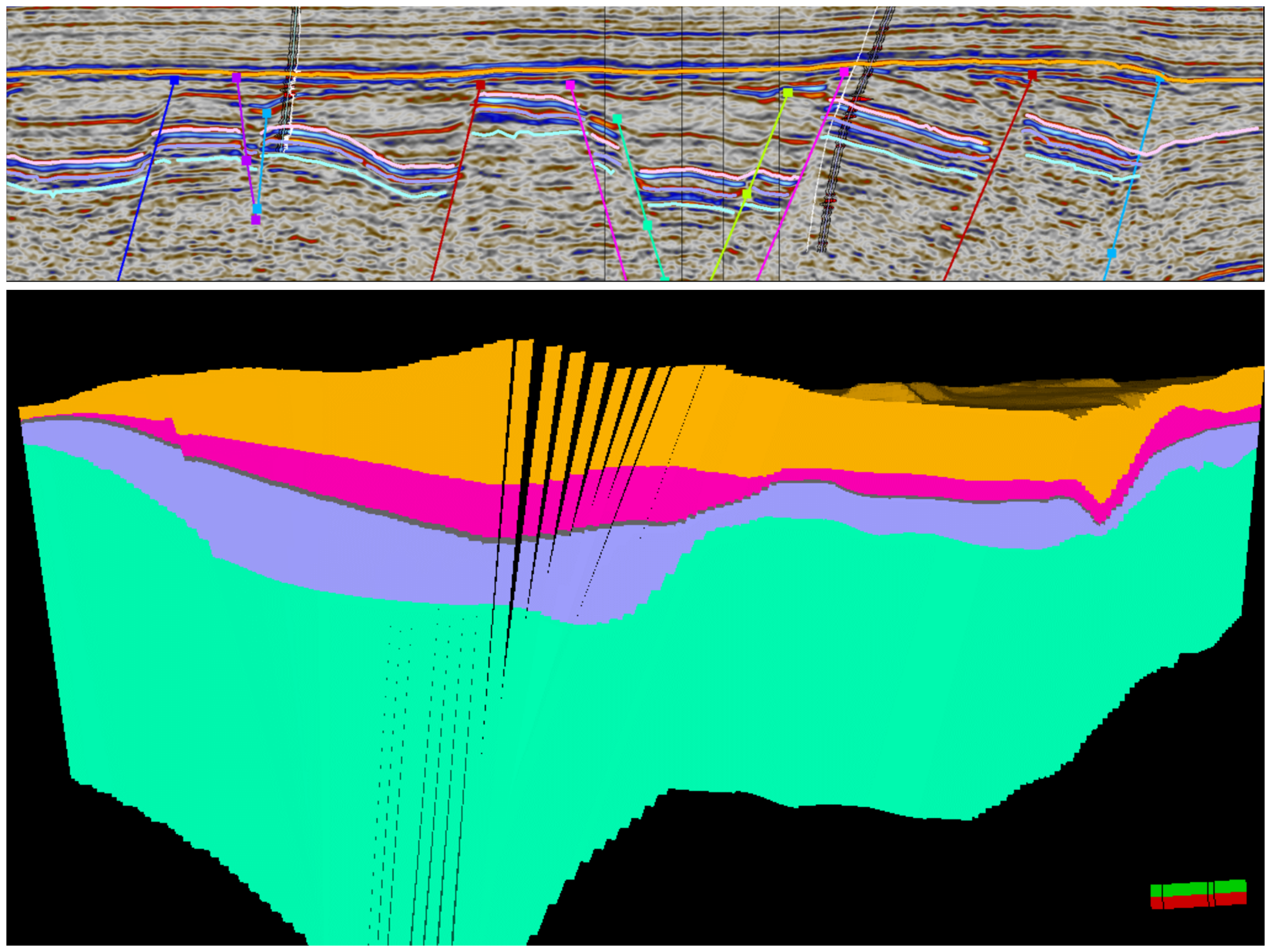
Veegeo supports Ennatuurlijk with geological evaluations for the development of their geothermal operations. We have constructed a geological model of an exploration area of Ennatuurlijk. For this subsurface model we used Schlumberger’s Petrel software package. The geomodel is based on 2D and 3D seismic reflection data and borehole data of the surrounding wells (standard log-suites). Together with our colleagues in The Hague and Calgary we built a static geomodel using a detailed workflow that included: Seismic Mistie Analysis, Seismic Attribute Analyses (structural smoothing, variance, etc.), Synthetic Seismograms andWell-to-seismic Ties, 2D and 3D interpretation of key faults and horizons, TWT mapping, and Velocity Modelling and Depth Conversion. This subsuface model is subsequently used by Ennatuurlijk to investigate the geothermal potential and find the ideal doublet configurations.
Besides the geological evaluations, Veegeo also provides Ennatuurlijk strategic advice on geo-hazard management in the region surrounding an exploration licence. Here, Ennatuurlijk is planning to develop a geothermal doublet as a sustainable option to provide heat to the local district-heat network. As this area is located withing the naturally tectonically active Roer Valley Graben, some potentially active faults are present nearby. It is important to locate and characterize these faults.